Buy TZ MAPS, C-MAP Raster, C-MAP Vector, and Tidal Charts for nautical charts and inland waters. Compatible with TimeZero & Furuno chartplotters.
Sail360 provides a wide range of nautical charts for boaters, professional mariners, and fishermen. Our charts ensure precise navigation at sea, coastal, and inland waters.
Chart types and compatibility:
- TZ MAPS – Advanced electronic sea charts, compatible with TimeZero Navigator v5, TimeZero Professional v5, Furuno NavNet TZtouch XL, and TZ iBoat for iPhone and iPad. Not compatible with Furuno NavNet TZtouch 3. Includes one year of free updates, up to 4 times daily via mobile network.
- C-MAP Raster Charts – Digitalized paper charts with high-detail visuals. Ideal for realistic navigation. Compatible with TimeZero software & all Furuno chartplotters.
- C-MAP Vector Charts – Scalable charts with intelligent routing, interactive POIs, and zoom functionality. Compatible with TimeZero software & all Furuno chartplotters.
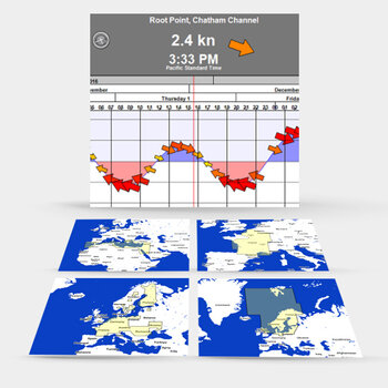
- Tidal Charts – Essential for coastal and inland navigation, displaying real-time tidal levels, currents, and water depths.